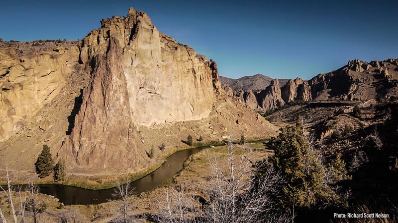
CROOKED RIVER
The Deschutes Partnership has accomplished the following in the lower Crooked River:
Land Conservation:
The Deschutes Land Trust’s primary objectives in the Crooked River are to: (1) protect stream corridors to facilitate restoration and protect restoration investments; (2) protect a select few areas that have outstanding ecological attributes (e.g., spring or tributary inputs, wetlands, working forests) extending beyond the floodplain area. Because the predominant land uses in this area are ranching and farming, conservation for the most part will take the form of working lands conservation easements.
The Land Trust’s initial focus areas is McKay Creek, which has good potential for restoring spawning and rearing habitat, and where coordinated restoration strategies are beginning to take shape. The mainstem Crooked River is a longer-term goal, particularly between Prineville and Highway 97, where stream flow issues make restoration more challenging. This agricultural area, which was characterized historically by large wetland complexes and a prolifically meandering stream channel (hence the river’s name) is at significant risk of fragmentation as Central Oregon’s population continues to increase.
Streamflow Restoration:
In McKay creek, a tributary of the Crooked River, the Deschutes River Conservancy will restore up to 11.2 cfs and eliminate of all direct creek withdrawals from rivermile 6-12. This will be achieved through exchanging McKay Creek water rights with Ochoco Irrigation District water rights from the larger Crooked River system and permanently transferring the McKay rights instream. Partners expect to meet the state instream water right of 6 cfs wet water in June, benefiting steelhead emergence and migration.Stream Habitat Restoration:
Fish Passage and Screening:
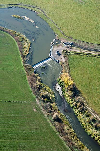
Through 2017, the Crooked River Watershed Council has addressed passage and screening at 13 of 17 sites considered to be significant barriers. Given available funding, the Crooked River Watershed Council expects to complete the remaining four passage projects by the end of 2022. The most critical passage project remaining in the Crooked is Opal Springs diversion dam located about one mile above the confluence with Lake Billy Chinook. This barrier blocks access to approximately 130 miles of habitat in the lower Crooked River, including McKay and Ochoco Creeks.
Stakeholder Engagement:
The Crooked River Watershed Council will conduct community-level outreach focused on successful reintroduction of ESA-listed species into a working lands watershed. The stakeholder engagement will be centered on ensuring that landowners, irrigators and others feel informed, engaged, aware and comfortable with the reintroduction as a positive influence in the watershed that will negatively affect their livelihood. The Crooked River Watershed Council will work with ODFW, NOAA, PGE, and others to design, develop, fund, and co-host an annual public forum on the topic of reintroduction in the Crooked River.
Effectiveness Monitoring: